

WV Historic Highway Markers, In Braxton County
March 22, 2021The West Virginia Highway Historical Marker Program was initiated in 1937 as part of the New Deal as a way to encourage tourism during the Great Depression. The West Virginia Commission on Historic and Scenic Markers worked with the State Road Commission, Works Progress Administration, and Federal Emergency Relief Administration to place 440 markers during the first year alone. After World War II, markers were placed at the sites of most state-run facilities and schools. The West Virginia Historic Commission took over the program in 1963. Since the late 1960s, the program has been managed by West Virginia Archives and History, which is today part of the West Virginia Department of Arts, Culture & History.
Below, find details relating to all of the historic markers located around Braxton County. Information pulled from wvculture.org
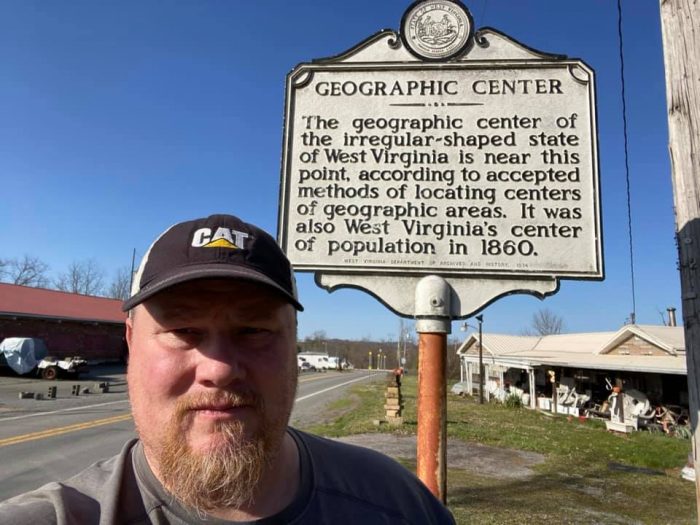
| Title: Geographic Center Inscription: The geographic center of the irregular-shaped state of West Virginia is near this point, according to accepted methods of locating centers of geographic areas. It was also West Virginia’s center of population in 1860. Location: Elk River Hunting Area Road, Bakers Run, south of Sutton |
| Title: Big Dunkard – Burning Springs Sand Inscription: The Mahoning Sandstone forming the cliffs and the Freeport Sandstone forming the falls of the Little Kanawha River respectively are the “Big Dunkard and Burning Springs Sands” of the driller. These sandstones yield oil and natural gas in West Virginia. Location: US 19/WV 4, north of Falls Mill |
| Title: Bulltown/Bulltown Battle Inscription: Important point in plan of Washington to establish water transportation to West. Salt was made here as early as 1792. Attack by whites in 1772 upon Captain Bull’s Indian village here was among the causes of Dunmore’s War.On October 13, 1863, a force of 400 Union troops under Captain W. H. Mattingly, entrenched on the hills to the northeast, repulsed attack of Confederate forces under Colonel W. L. Jackson. Jackson retreated after some loss into Pocahontas County. Location: US 19/WV 4, Bulltown |
| Title: Sutton Inscription: Named for its founder. Burned, 1861, by Confederate troops. First settlers in this county were Jeremiah and Benjamin Carpenter, who had settled on Elk River, 1784. Soon after, Benjamin and wife were killed by the Indians. Location: Main Street (CR 19/40), Sutton |
| Title: Braxton County/Lewis County Inscription: Formed from Harrison in 1816. It was named for Colonel Charles Lewis, who was killed in 1774 at Battle of Point Pleasant. It was home of Jesse Hughes, frontier scout, and the boyhood home of General Thomas J. “Stonewall” Jackson.Formed in 1836 from Lewis, Kanawha, and Nicholas. Named for Carter Braxton, signer of the Declaration of Independence. Washington planned to establish important point in project for western communication in this county. Location: US 19/WV 4 |
| Title: Braxton County/Clay County Inscription: Formed, 1836, from Kanawha, Lewis, and Nicholas. Named for Carter Braxton, one of the signers of the Declaration of Independence. Washington planned to establish important point in project for western communication in this county.Formed in 1858 from Braxton and Nicholas. Named for Henry Clay, the great Kentuckian, who was so popular in western Virginia that in 1820 a monument was erected to him for his part in bringing the National Road to Wheeling. Location: WV 4 (missing) |
| Title: Braxton County/Nicholas County Inscription: Formed, 1836, from Kanawha, Lewis, and Nicholas. Named for Carter Braxton, one of the signers of the Declaration of Independence. Washington planned to establish important point in project for western communication in this county.Formed in 1818 from Greenbrier, Kanawha and Randolph. Named for Wilson C. Nicholas, governor, Virginia, 1814-1817. In this county in 1861 sharp engagements were fought at Kessler’s Cross Lanes and at Carnifex Ferry. Location: US 19 |
| Title: Braxton County/Gilmer County Inscription: Formed in 1836, from Lewis, Kanawha, and Nicholas. Named for Carter Braxton, signer of the Declaration of Independence. Washington planned to establish important point in project for western communication in this county.Formed in 1845 from Kanawha and Lewis. Named for Thomas Walker Gilmer, Secretary of the Navy in Tyler’s cabinet, who was killed in an accident on a war vessel. Farming is important, particularly sheep and cattle raising. Location: WV 5 |
| Title: Town of Burnsville Inscription: Area first settled in 1798; Payton Byrnes came in 1830. First known as Lumberport in 1866, when Capt. John Burns established first saw mill in area. Incorporated by county in 1902 and named for Burns. Location: WV 5, near I-79 exit 79, Burnsville |
| Title: Skirmish at Salt Lick Bridge Inscription: On October 13, 1863, Confederate troops under Col. W. L. “Mudwall” Jackson attacked Union forces at Bulltown, where they were repulsed by elements of the 6th and 11th WV infantries. Compelled to withdraw, Jackson’s men retreated to Salt Lick Bridge and camped overnight. After a brief skirmish with part of the 4th WV Cavalry on October 14, their retreat continued unhindered. Location: US 19, north of Flatwoods |
| Title: Burning of Sutton Inscription: On December 29, 1861, Confederate partisans attacked a company of the 1st West Virginia Cavalry at Sutton. After ammunition ran low, the Federals left with part of the Confederate force in pursuit. When the Confederates returned, they found the town afire. Reportedly begun when one house was torched by partisans attempting extortion, the fire destroyed part of Sutton. Location: Main Street (CR 19/40), Sutton |